
Note: The Berger Collection Educational Trust recently gave the DAM 65 British masterworks. Learn more about this transformational gift.
A landmark world map from 1532, part of the Berger Collection, is on view for the first time at the Denver Art Museum as part of Stampede: Animals in Art.
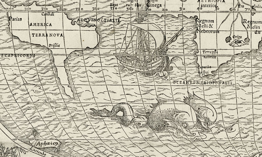
This is what a map of the world made by Europeans looked like 500 years ago. Europeans had recently begun the so-called voyages of discovery, and this map reflects some of the latest knowledge about the world that resulted from those voyages. South America and southern Africa are recognizable, but North America appears as a slender vertical rectangle deeply indented at its midpoint, while North and South America are represented as two separate land forms.
This map appeared in one of the first printed books devoted to the history of travel, Novus Orbis Regionum (“New Regions of the World”), published in Switzerland in 1532. The book contained accounts of the voyages of Columbus, Amerigo Vespucci, and Marco Polo. It was widely popular and was reissued throughout the sixteenth century.
Sea Monsters & Mermaids
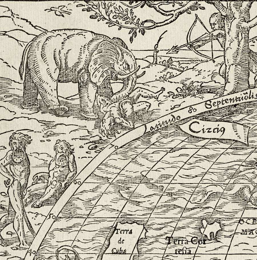
The map caught the eye of Berger Collection founders Mr. and Mrs. William M. B. Berger because its illustrations are attributed to the German artist Hans Holbein the Elder, best known as portrait painter to King Henry VIII and the artist of the Berger Collection’s prized picture Edward, Prince of Wales (later Edward VI). The map’s illustrations combine the fanciful and the real. Sea monsters and mermaids populate the oceans, as does a contemporary sailing ship.
At the north and south poles winged figures turn a crank, believed to be the first representation of Nicolaus Copernicus’ theory of the rotating earth.
But the map marks a new chapter in how artists represented the world. Gone are the creatures that appeared in medieval illustrations—cyclops, men with six arms, and other fantastic figures thought by Europeans to inhabit the farther reaches of Africa and Asia.
Typus Cosmographicus Universalis, 1532. Woodcut printed on two sheets of paper adhered together. Map created by Simon Grynaeus (1493–1541) and Johann Huttich (about 1480–1544). Illustrations attributed to Hans Holbein the Younger (1497/8–1543).
This world map is one of the first to be so adorned, but by the end of the sixteenth-century maps with elaborately illustrated borders had begun to proliferate. Illustrated maps came to be valued as prized possessions of collectors, who proudly exhibited them in rooms devoted to their display – the so-called curiosity cabinets that served as progenitors of the modern museum.